Hiking
- Buena Vista, Colorado -
Explore the Arkansas River Valley
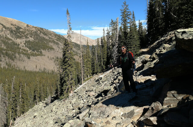
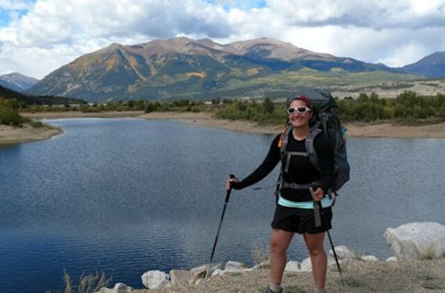
We are so fortunate in Colorado to have beautiful hiking trails ranging from a leisurely walk in the woods to tackling a 14’er. Since hiking in and around Buena Vista is the best way to experience the Collegiate Peaks and Arkansas River Valley, we have included some of our favorite hikes here.
Hiking Trails near Buena Vista
We are so fortunate in Colorado to have beautiful hiking trails ranging from a leisurely walk in the woods to tackling a 14’er. Since hiking in and around Buena Vista is the best way to experience the Collegiate Peaks and Arkansas River Valley, we have included some of our favorite hikes here.
Midland / Barbara Whipple Trail
The trailhead is located in the Buena Vista River Park in Downtown Buena Vista. The Barbara Whipple Trail (aka “The Whipple Trail”) offers a variety of hikes, from the nice and easy to those that are a bit more challenging. This trail system offers grand views of the Collegiate Peaks to the west and interpretive information of the railroad along many of its trails. This trail system in many ways provides the full Colorado experience.
Denny Creek Trailhead
Take CR 306 west for about 12 miles, the Denny Creek Trailhead on the right-hand side of the road. This trail also leads up to Mt. Yale, one of Colorado’s beautiful 14ers.
Ptarmigan lake Trail #1441
This trail is a popular destination for hikers; the total length of the trail is 3 miles and gently winds east and south to the timberline ending at an 11 acre lake. This lake often provides excellent fishing for native cutthroat trout. Overnight camping is suggested at a lower elevation below the tree line, but is not permitted at the trailhead. This is about a 1-1 ½ hour hike to the lake, if you want, you can climb to Jones Mountain which is one of the higher 13er’s in Colorado.
Share
Area Adventures
Contact Us
Grizzly Lake / Grizzly Gulch Trailhead
Take 285 south for about 5 miles from Johnson village, turn right onto CR 162. From the town of Nathrop (south of Buena Vista and north of Salida on Hwy 285) take County Road 162 West into the Chalk Creek valley. The intersection of County Road 162 and Hwy 285 is directly across the road from Chalk Lake Campground. Follow CR 162 for 16 miles, the Grizzly Gulch Trailhead is on the left side of the road; located before St. Elmo. It’s about a 3 mile hike to the lake.
Browns Creek Trail
The Browns Creek Trail offers beautiful scenery with changing vistas and vegetation. The trail follows the creek and many small waterfalls may be found along the way. This trail is great for hikers and horseback riders. There is a vault toilet located at the trailhead. The Browns Creek Trail is a 3.5 mile loop, but there is also an 8 mile and an 11 mile loop.
Hiking 14ers in the Buena Vista Area
Mt. Princeton
Take 285 south for about 5 miles from Johnson village, turn right onto CR 162. From the town of Nathrop (south of Buena Vista and north of Salida on Hwy 285) take County Road 162 West into the Chalk Creek valley. The intersection of County Road 162 and Hwy 285 is directly across the road from Chalk Lake Campground. Drive about 4 miles on CR 162, then turn right onto CR 321. Follow CR 321 for approximately 1 mile and then turn left onto CR 322. Stay to the right to reach the Mt. Princeton Trailhead. This is a gorgeous 14er to climb with a summit of 14,197 feet!
Mt. Yale
Drive for 12 miles on CR 306 to Denny Creek Trailhead. Follow the signs on the trail that lead to Mt. Yale summit which is 14,196 feet!
Mt. Elbert
Colorado’s Highest 14er with the summit at 14, 433 feet! From U.S. 24 just south of Leadville, turn onto Colorado 300 and cross the railroad tracks. Drive 0.7 mile and turn left onto County Road 11 toward Halfmoon Creek. Follow CR 11 for 1.2 miles, turn right onto the dirt road to Halfmoon Creek; drive on the “good” dirt road (except for the usual washboard and potholes) for 5 miles. The trailhead to Mt. Elbert trailhead will be on the left. The trailhead has a large parking area with restrooms.
Continental Divide Hiking Trails
Hancock Lake
3.5 mile out and back hike. The trip will follow the CDT toward Hancock and over Chalk Creek Pass and will highlight new trail constructed by CDTA. Elevation: trip ranges from 11,600 feet to 12,000 feet. Be prepared for inclement weather!
Old Monarch Pass Trail
Old Monarch Pass is popular trip with good views at the top of the Continental Divide. This 1.3 mile road to the top is the 1919 pathway taken over the Divide and is today known as Old Monarch Pass. It is a pleasant gravel road in the summer and a favorite cross-country ski route in the winter.
Boss Lake
4.5 mile long out and back trip. The hike will follow the CDT around Boss Lake and toward the Continental Divide, ending at Hunt Lake. Elevation: trip ranges from 10,400 feet to 11,520 feet. Be prepared for inclement weather!
Hope Pass
This is a moderate to difficult 8 mile hike out and back. The trip begins at the Willis Gulch Trailhead, which is off of CO 82 and follows the CDT/Colorado Trail to Hope pass. The first part of the trail is very steep. Elevation: trip ranges from 9,300 feet to 12,500 feet. Be prepared for inclement weather!
Stay at A Riverhouse Lodge
Live the adventure along the Arkansas River in Buena Vista, Colorado.